Facebook has all the photos for this part of the trip – click here to have a look.
Nkhata Bay, Malawi
2nd – 4th December 2013
After agreeing to transport one oversized mama Malaiwan traffic cop who had requested transportation to Rumphi, I scrambled to clear the passenger seat littered with things I need at arms reach when driving. Watching her heave her large frame off the ground and into my raised-suspension Beast was quite something. I had to give her instructions about where to put her feet and where to hold to help pull herself into the cruiser. Once inside, she flumped into the seat, wiped the sweat off her brow, laughed and slapped her thigh with relief.

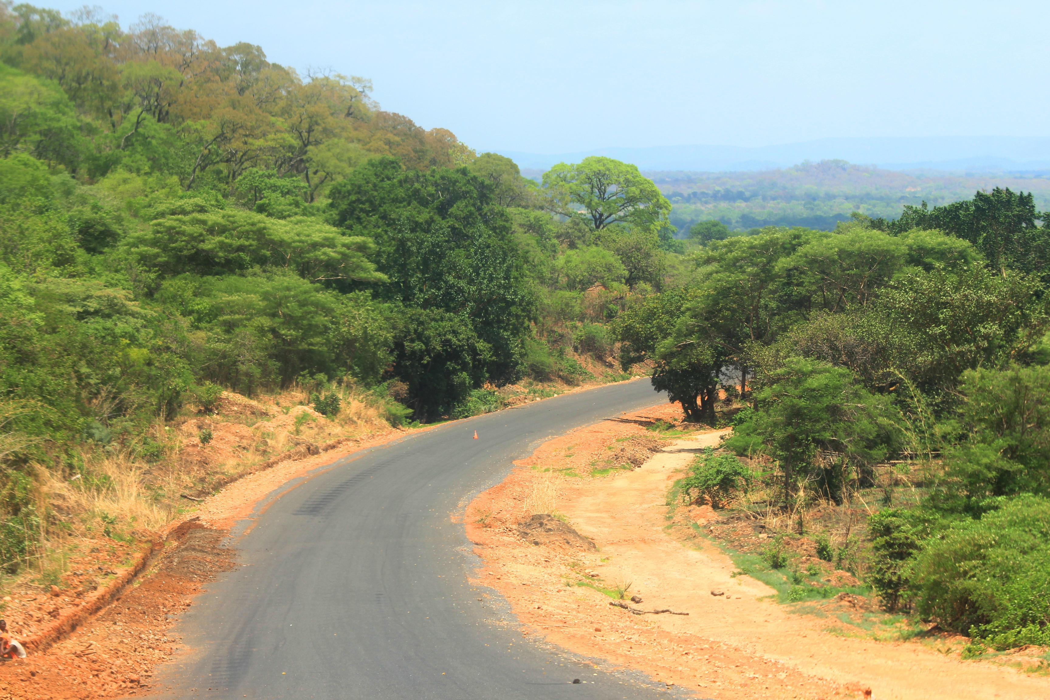
Escarpment Road near Chitmiba
“My name is Thelma. My people can’t say it right, so just call me ‘Felma’. You may proceed.”
So off we drove, me and Felma.
After around 20 minutes, I noticed she wasn’t wearing her seatbelt, so I asked her to buckle up in case I was stopped by a traffic cop and fined breaking the law for transporting a passenger with no seatbelt.
“Ha, you will be fine with me in the car. They will see me and know I am in charge.” she said laughing.
She buckled up anyway and I was quite surprised (and glad) to see the seatbelt had enough length for her girth.
The next hour or so was spent discussing Malawian policing systems, education, family life and anything else I could find to keep Thelma talking. The drive takes you away from the lake, up and over some beautiful mountain passes. Rumphi was a little off my bearing but I decided to drive Thelma all the way to the local police station and dropped her off inside their compound. She was so chuffed and got the rest of the cops a the Rumphi Police Station to come out and wave me goodbye.
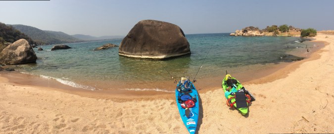
My next stop was Nkhata Bay. With the lure of cobalt blue waters, I was excited to see this bay I’d heard so much about. Now what people hadn’t told me, was that there is no real camping in Nhata Bay as the town is set on the sides of a rocky hill and there is no flat ground, or campsite to be found. I made my way over to a few of the recommended places to stay in the Lonely Planet and found Mayoka Village to be the best option.
With individual huts perched on top of a steep rocky shoreline of crystal clear waters, Mayoka Village is a maze of undulating pathways and steps from huts to ablutions to restaurant. I paid for two nights and got settled into my grass hut overlooking the bay. For two days I completely relaxed. I read, swam, snorkelled, ate and tried to get as much note taking and blogging done as the restaurant had free wifi. Free if you want to join the other twenty guests sharing the bandwidth and wait half an hour for a picture to load…
Whilst this was stop was wonderful, I really was in search of a beach that I could camp next to and, on recommendation, I set off for Chintheche, 50 kilometres south of Nkhata Bay.

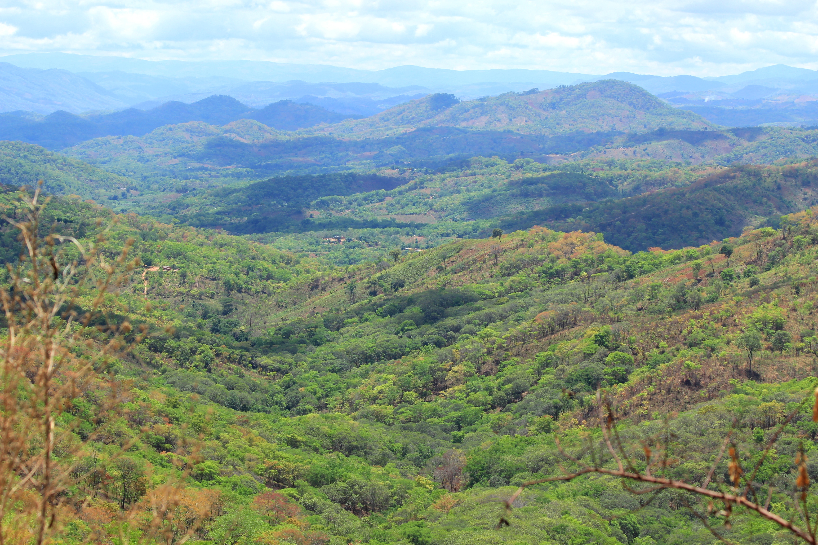
View on route from Nkhata Bay to Chintheche
Chintheche Inn, Malawi
4th – 8th December 2013
With no real village or town in sight, Chintheche Inn is on a remote and beautiful stretch of the lake. The gates opened up and I was immediately greeted by really friendly staff, the kind who insist on showing you around, explaining the ins and outs of the place. The inn serves as a cabana-type hotel on the shore of the lake and the remaining grass area is available for camping. Considering I was in Malawi, US$15 per night is by no means a cheap stay but it was just what I was looking for and I almost had the place to myself. The only other guests in the campsite were Callie and his two sons James and Peter, who were riding from Cape Town to Egypt. The boys couldn’t have been older than 16 and 18 – what a great thing for a father and his sons to do together. I heard them start up their motorbikes before the sun rose the next morning, and they were off. I do hope they made it all the way up!
I parked the Beast under a large mango tree and immediately went for a swim in the most incredibly warm and calm waters. I’d been informed that there was a resident crocodile that would swim by every now and then, but not to worry because they had locals looking out for him. Nothing like placing your reassurance in something as insubstantial as that. I would have to take my chances.

Lake Malawi from the shores of Chintheche
Over the next few days, I took root and for the first time since leaving Diani Beach, I stayed in one place for more than two nights. I hit the repeat button on my daily routine of waking, swimming, eating, reading, swimming, blogging and sleeping and just kicked back. With no one else in sight, I had a small kingdom of paradise to myself. Waking with the birds and watching the sun rise over the lake from the window of my lofty green castle, I would survey my private kingdom below. The campsite and lake became my playground and the trees dropped sweet, ripe mangoes for me daily.
")
Masterchef Malawi

Dip in the Lake Malawi
")
Beach all to myself
After a couple of months on the road, you find that you really don’t need much to sustain a relatively passive form of living. I had been given a bag of biltong by Paul Metcalf when leaving Mbeya in Tanzania a few weeks earlier and was still rationing out 2 or 3 pieces a day. Nuts and dried fruit were a favourite and if I found time in the evenings I would cook some garlic rice and mix in a dollop of Malawi’s incredibly Nali sauce which adds a peri-peri kick to the meal. Other than that, I was happy with tomatoes of which there was always an abundance of at roadside stalls. But it was those sweet mangoes that I looked forward to every day and I could have lived under that tree for weeks if time hadn’t been a bit of an issue.

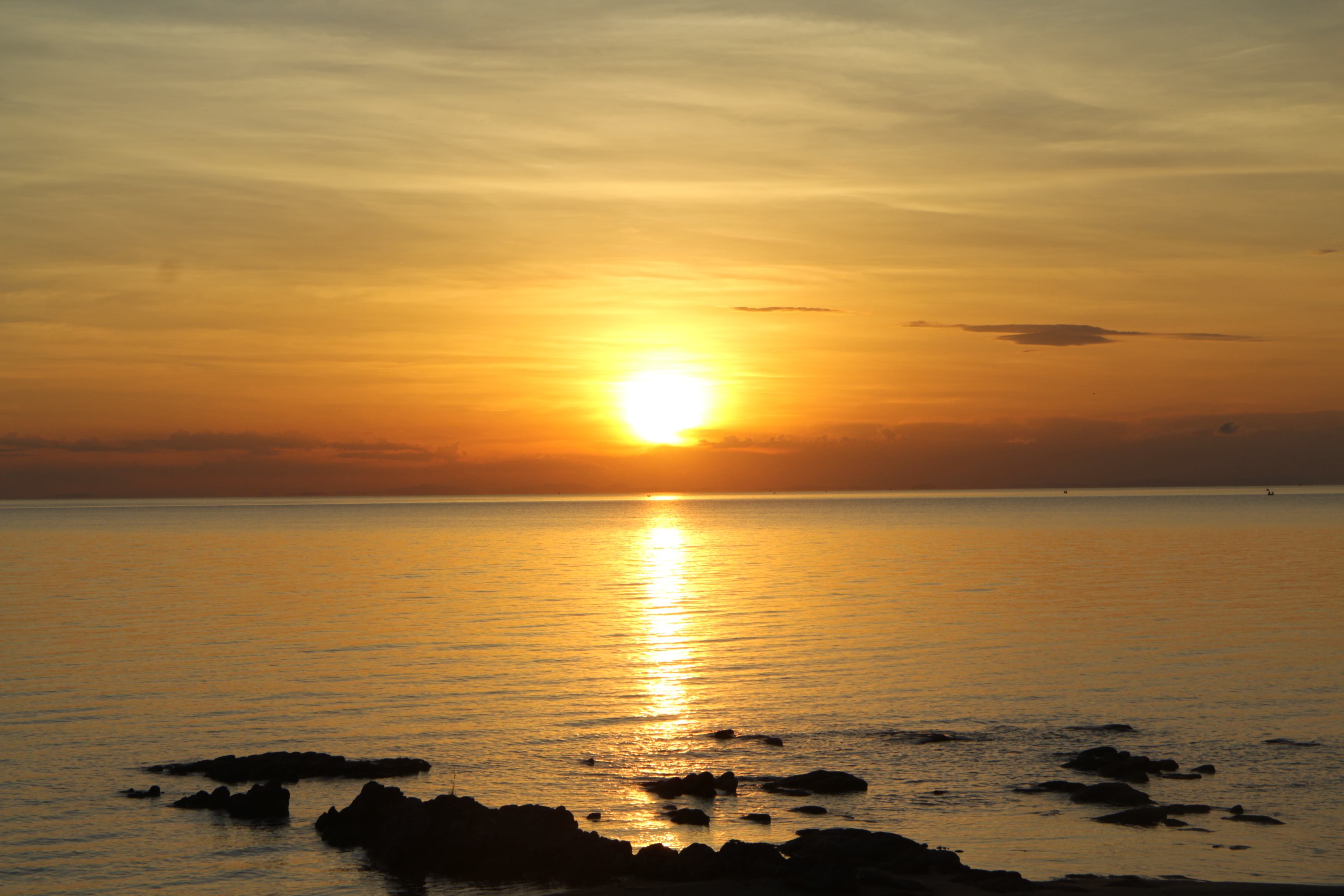
Sun setting over Lake Malawi
Whilst at Chintheche I met two ladies who were staying at the inn. Janet comes out every year for a few weeks to continue the work set up by her charity following her daughter’s passing. She raises money for the local orphanage school and brings in supplies, desks, chairs and school books. I also met Ruthe who has been working on a homeopathic malaria prevention programme. She has been working in the area for some time now, administering this to local children and has been monitoring the programme for some years now with fantastic results. As I was not on any prophylactic of my own, I took some of her muti, enough to last for the rest of my trip (it’s only a sip per day) and swigged the required dosage each morning. Needless to say I never got malaria.

Ruthe and Janet – woman warriors out to make a change.
It was at Chintheche, that I witnessed the infamous lake flies. I took a walk down to the lake one morning and saw, what can only be described as black smoke or dark spiralling clouds brooding on the horizon which grew constantly. I have been told that the fly larvae live on the lake bottom where they feed. When they form pupae they float to the surface and hatch all at once causing the giant swarms. Winds often blow them to the shore and women from local communities catch them in baskets and squash them together to create a local delicacy (a burger-like patty which is then deep fried). I was most upset when this swarm made landfall that evening. Before I knew it they were everywhere. Every light attracted a million of the damn creatures and I have never been caught up in a swarm of so many insects – up your nose, in your mouth and eyes – just completely unpleasant! Dashing back to the safety of my tent, I was then confined for the rest of the evening knowing that my light was drawing them to the mesh of my windows. I woke up the next morning to find piles of dead lake flies under every possible light fitting. The local ladies were besides themselves, running up and down the beach with their baskets full of the blady things!
")
Chintheche Inn
")
Chintheche Beach
")
Chintheche Campsite
")
Infamous Lake Flies
")
Underneath my Mango Tree
A day later I woke to the sound of a morning storm. I have seen a fair few storms in my time but this was on the heavy end of the spectrum. The tent was getting absolutely lashed but Howling Moon have a good rep for a reason but with the sheer volume of water things were starting to sag. I zipped up the canvas windows and with a bit of maintenance to prevent the water pooling and weighing the roof down, I remained mostly dry. The battery on my phone was just about dead and, as I was hoping to leave that morning, decided to get down to the cab, start the engine and charge the phone to do a bit of research for the road ahead. Racing from under the tent at the back of the Beast, opening the door, flinging myself in – I was drenched, and so were the books in the door holder… I plugged in the phone, turned the key and… nothing… battery had flatlined! That’s what you get for running your fridge/freezer for 4 days without starting your wagon. Plan B. I raced across the campsite in the bucketing rain and lighting to the ablutions only to find that the power has been taken out by the lightning. Racing back to the Beast, now drenched, I didn’t want to sit inside the tent or on the seats for that matter. Luckily the rain had abated somewhat and I saw one of the gardeners under shelter nearby. I ran over to ask if he could help me find someone to charge the battery. A short while later I had the camp manager, DK, and a team of workers with their camp vehicle trying to jolt some life into my batteries. They had considered removing both my batteries and running them down to the village where they have a battery charger but the power was down in the entire area. After 3-4 hours of trying various things, it seemed hopeless! Eventually some clever clog got under the Beast and manually got the starter motor running which would set the batteries charging. By now the rain had stopped and it was midday. There was no way I was going to make it to Lilongwe. DK, looking at this drowned shivering rat, offered me a room at the inn for the night. Well, how’s that for incredible hospitality! Ahhhh you can’t imagine how good it felt just to take a warm shower, have nice fluffy towels and just have space to dry everything out. That night, tucked up in a divine double bed with crisp clean linen, I couldn’t sleep a wink and lay awake all night… typical.
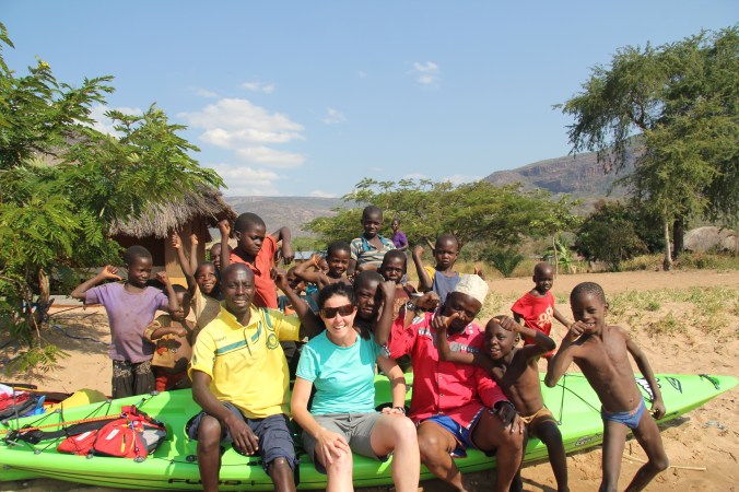
Before leaving the area, I took an exploratory drive down some incredible paths and tracks, and found the most smiley, inquisitive and friendly children playing in the fields, African children have beautiful souls and seem so content with life, without a care in the world. This was one of my favourite places of the entire trip.
Lilongwe, Malawi
8th – 9th December 2013
I had a pretty easy drive from Chintheche to Lilongwe, and like any capital town in Africa, it has it’s perks – western restuarants and malls greeted me as I drove through the streets. I drove out to Barefoot Camp which had been recommended in the guide books but found that, although the lawns were nice, it was a long way out of town and wasn’t serving food. So I drove back into town and bought a few groceries. By this stage I just wanted to stop for the day and chose to check out the campsite at Sanctuary Lodge which was in town. The campsite is attached to the Sanctuary (don’t be fooled by the name, it’s nice but not that nice…) and, as it borders a wildlife reserve, is beautifully lush with heavy leaved trees and thick lawns. Again, I was the only person in the campsite but it was pleasant and so were the ablutions (always a plus). that evening I made my way up to the lodge to gain access to their free wifi and on retuning at around 9pm that night (with a guard in tow), found the back of the Beast completely open. In my haste to get to the Lodge three hours previously, I had completely forgotten to close the tail gate and lock up… absolutely everything was in place and not a thing was missing. With everything I owned, including my passport and all the money in my possession inside, I had undeniable sidestepped a major crisis just then… thank you Africa!
*Not a thing was stolen thoughout my entire journey, except a 2l bottle of prized Mazoe concentrated juice from the back of my Beast in Cape Town… pretty incredible!*


 I started the journey with a fellow South African, Simon Dunshea, who paddled with me from the most southern most town, Mpulungu in Zambia, up to Kigoma in Tanzania. From Kigoma onward, I had the pleasure of paddling with Tanzanian guide, Gaspar Kazumbe, to the most northern point, Bujumbura in Burundi.
 This couldn’t have been more true on this journey, and just a week ago I was still being denied access into Burundi. Sometimes taking a small risk and seizing an unlikely opportunity makes all the difference and I honestly feel that the drawbacks and delays that I experienced over the course of the expedition triggered alternate plans which worked far better than initial arrangements.
 Thanks so much to


 UPDATE: 9 months after my journey started, I pulled into Cape Town. Tanned and happy, after living day to day in the most simple form, I have never felt more free, more alive and more content with life. I think about this trip and about the possibilities for more adventures daily. Dream big and go for it!


")
")
")
")
")
")
")
")
")
")
")

")


")
")
")
")
")
")
")

")
")
")
")
")
")
")
")
")
")


")
")
")
")
")
")
")
")
")


")
")
")

")
")
